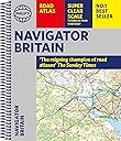
Philip's Navigator Britain: Spiral (Philip's Road Atlases)
Product ID: 476701161
Desertcart purchases this item on your behalf and handles shipping, customs, and support to Iceland.
Philip's Navigator are Britain's bestselling detailed road atlases - exceptional for their scale and clarity. 'A map that beats all others.' - The Daily Telegraph 'Scale, accuracy and clarity are without parallel.' - Driving Magazine 'No.1 in the UK for clear maps.' - Independent research survey - Scale: 1.5 miles to 1 inch = 1:100,000 (Northern Scotland: 3 miles to 1 inch = 1:200,000) - Super-detailed 6-page route-planning section. - Every street in Britain is marked on the maps. - Over 3000 roads clearly named. - Featuring major National Trails such as: Hadrian Wall's Path, Offa's Dyke Path, Pennine Way, South Downs Way, Thames Path, The Ridgeway, West Highland Way and Southern Upland Way. - 100 indexed town-centre maps plus approaches maps to 12 major urban areas. - Exceptional road detail, from motorways to country lanes, with every junction, roundabout and slip-road shown. - Thousands of individually named farms, houses and hamlets. - The No.1 Choice of Road Atlas for the serious motorist. Available in an easy-to-manage spiral paperback binding, Philip's Navigator Britain is widely used by professional drivers and the emergency services, including national police training, and is recommended in the motoring press and national newspapers. No other road atlas of Britain offers this level of detail and clarity. Review: The fourth edition I've bought, after wearing out earlier ones from use! - I've just bought the latest edition. I've owned and used three earlier ones over about 30 years, each now pretty battered and overtaken by new road schemes. Love the scale and detail. Review: Have and tourist - This is a larger scale map and therefore shows more detail than the usual road atlas. Ideal for touring in the uk !

| Best Sellers Rank | 19,748 in Books ( See Top 100 in Books ) 70 in Historical Atlases & Maps 83 in Earth Sciences & Geography References 118 in Geography References |
| Customer Reviews | 4.6 out of 5 stars 152 Reviews |
I**H
The fourth edition I've bought, after wearing out earlier ones from use!
I've just bought the latest edition. I've owned and used three earlier ones over about 30 years, each now pretty battered and overtaken by new road schemes. Love the scale and detail.
B**V
Have and tourist
This is a larger scale map and therefore shows more detail than the usual road atlas. Ideal for touring in the uk !
A**R
great product
this is an excellent map
P**G
Great atlas
It's a great detailed road atlas... what more can I say...we bought this because my mother in law, had an old shabby falling to pieces, one and we were always pinching it, she liked to follow where we were going in our motorhome. I know everyone has apps and gadgets, but you can rely on a good ol' fashioned atlas too, especially when signal goes or whatever.
K**E
An ideal production for all users
Excellent product! Scale ideal for reading all mapping Details.
C**E
Highly detailed road atlas maps
Highly detailed maps - the inclusion of farm names is very helpful. However, the atlas is very heavy, so rather unwieldy if you need to refer to it when driving solo. The margins on spiral bound maps also mean a big gap between pages, which can be annoying if the area you're looking at is right in the middle. The atlas includes a long list of city centre maps, but the scale is so small they're hard to read, so not very useful (a strange contrast with the very large scale of the main maps). The weight, and the water damage my copy sustained when delivered, mean I have returned it. I will be looking for a shorter, lighter road atlas instead.
M**E
Brilliant
Brilliant I,
H**.
Good detail
Very useful - strong binding - perfect size and weight - our two previous road maps (spiral bound) fell to pieces and tore easily in transit.
Trustpilot
1 month ago
3 weeks ago